wzesk/littoral_refine 🖼️🔢 → 🖼️
Performance
5.4sTypical run time
~19sCold start (first call)
5Total runs
About
refinement module to improve satellite derived shorelines
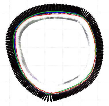
Example Output
Output
Performance Metrics
5.42s
Prediction Time
19.35s
Total Time
All Input Parameters
{
  "img_path": "https://raw.github.com/Wzesk/littoral_refine/2b77e90e1701e9da1ecf9142724ac1007848e9d1/sample/20241211T052119_20241211T052515_T43NCE_sr.png",
  "smoothing": 2,
  "mask_filepath": "https://raw.github.com/Wzesk/littoral_refine/2b77e90e1701e9da1ecf9142724ac1007848e9d1/sample/20241211T052119_20241211T052515_T43NCE_mask.png",
  "simplification": 0.5
}
Input Parameters
- img_path (required)
- Path to the input image for shoreline refinement
- smoothing
- Factor for boundary smoothing
- mask_filepath (required)
- Path to the input mask image file
- simplification
- Factor for boundary simplification
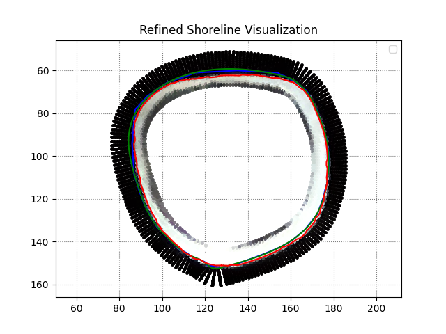
Output Schema
Output
Example Execution Logs
/src/predict.py:88: UserWarning: No artists with labels found to put in legend.  Note that artists whose label start with an underscore are ignored when legend() is called with no argument.
plt.legend()
Visualization saved to /tmp/refined_shoreline_visualization.png
Version Details
- Version ID
86a86582a6f0095ecb14ac420ebbc1be453b84553427520b0299baedba8258f9- Version Created
- January 10, 2025